Friday, September 30, 2016

Study Area: Indre By


copenhagen_map_history INDRE BY.jpgNote: Over today and tomorrow I will be posting a few rough bits from my final project. This post includes a fair amount of historical information that has previously been posted. Study Area: Indre By Indre By (“Inner City”) is the oldest part of Copenhagen. The administrative district of Indre By includes the area of the medieval city, the renaissance additions, the man-made island of Christianshavn, and the area between the old city and the “lakes” with a total area of about 4.65 km2. This area currently has a population of about 25,000, giving it a population density of about 5,600/km2. [I don’t yet have numbers for the current population of the old city without all the new areas included]
Prior to 1867 permanent buildings were prohibited outside the fortification ring to a distance of XX, meaning that the population of the entire city was confined to an area of about 3 km2. This population was about 60,000 in 1700 and by 1850 rose to 150,000, meaning that the population density increased from 20,000/km2 to 50,000/km2 over this time period. These conditions and the lack of a sewer system caused the development of an unpleasant and unsanitary situation in the city. However, the fortifications and controlled gates were key to the government’s collection of taxes on trade goods. A cholera outbreak in 1853 helped to finally bring about the decommissioning of the ramparts.


Large portions of this area were destroyed during the two great fires in 1728 and 1794 and by the the British bombardment of the city in 1807. As a result, nearly the entire district was rebuilt during the 18th century and early 19th century. The rapid replacement of such a large portion of the city’s building stock allowed a specific type of building to proliferate, with common features and proportions.


Study Block


Streets
The study block for this neighborhood is located between Brolæggerstræde (NW), Knabrostræde (SW), Kompagnistræde (SE) and Badstuestræde (NE) streets. These streets all have rights of way of about 8 meters. Brolæggerstræde, Knabrostræde and Badstuestræde are paved with asphalt and have sidewalks on either side that area about 1.5 meters wide, leaving about 5 meters for vehicles. Kompagnistræde is paved with cobblestones and concrete blocks and has no sidewalks, although changes in paving material indicate a vehicular travel-way of about 4 meters. Kompagnistræde is technically part of the Strædet pedestrian street, though there are no physical barriers to cars entering from adjacent streets.
Automobile and bicycle parking occupies one side each of Brolæggerstræde, Knabrostræde and Badstuestræde.


Block
The study block forms an irregular quadrangle with a total surface area of about 3,700 m2 or about 0.91 acres. It’s sides are 50, 70, 60, and 66 meters long (NW, SW, SE, NE) for a total perimeter of 246 meters. Building frontage along the perimeter is continuous. There are 14 street-fronting buildings on the block, 5 interior buildings, and 8 courtyards.


Parcels
The cadastral layout of the study block has changed relatively little since the development of the existing building stock at the end of the 18th century. A cadastral map from 1761 map shows parcels of highly irregular size and shape, all of which however include street frontage and a back area for a courtyard and backbuildings or wings. As of 1761 there remain two gaps in the streetwall along Knabrostræde and a total of 14 parcels.
The cadastral map from 1807, thirteen years after the Great Fire of 1794, shows a partial transformation of the block, with most of the building footprints slightly altered and several minor changes to parcel boundaries.  The cadaster maps show no change in the study block from 1807 to 1861, with a total of 13 parcels present. Since 1861 several parcels have been combined, dropping the total parcel count down to 10. The two instances of parcel combination (on the SW side of the block) have occurred around shared courtyards, suggesting it is more advantageous to consolidate parcels where buildings make use of common entrances and open space.


cadaster1761.jpgcadaster1860.jpgcadaster2016.jpg
1760 1861 2016


Buildings
At present there are 19 buildings on this block, all built between 1700 and 1799. More than half were built in the late 1790s after the Great Fire of 1794. They are fairly consistent in scale and style, the main outlier being 18 Badstuestræde, which is significantly larger and has a more ornate facade than others on this block. It is also the only building to fully enclose a courtyard. Almost all of the buildings on this block feature ground-level retail uses, and many of the former dwelling units have been rented out as offices. All represent some permutation of the “Golden Era Apartment House” type delineated below.

IB elevations.jpg

Density
At present the block contains approximately 115 units, however according to government records, only 68 units are used for housing. With a block area of 3,700m2 this yields a density of 184 dwelling units (DU) per hectare or 74 DU per acre. The current average household size in Denmark is 1.7 [cite] leading us to an estimate of 129 residents per acre.
We can be sure that this number was higher in the past. With all 115 units occupied at least part time as residences, the block’s density would have been 125 DU/acre. If we take the average household size (4.2) in Soren Kierkegaard’s similar apartment house as normal, we get a block population of 483, or 525 per acre.
It is reasonable to think that a certain number of the units not listed as residences are used as AirBnB or other short term rentals, indicating that the current density may be higher than indicated by government figures.

Rents/Valuation
Three flats are currently for sale on the study block. Their asking prices are $700,000  (Badstuestræde 16), $825,000 (Badstuestræde 18D) and $1.6 million (14 Kompagnistræde). Respectively these units are 97m2, 136m2 and 179m2 in size, giving us valuations of $7,220 per m2, $6,066 per m2 and $8,940 per m2.

Traffic
A traffic count conducted during morning rush hour on Kompagnistræde observed 166 passersby. About 72% of these were on bicycle, 23% on foot, and the remainder in vehicles. About 10% of the passersby entered or left from one of the buildings on this part of Kompagnistræde (including the opposite block). Of the cyclists, a slim majority were female; of the walkers a slim majority were male; and all of the passersby in vehicles (9 people in 7 vehicles) were men. Only one child passed by during the observation period.

Thursday, September 29, 2016

Schengenanigans

I won't be surprised if this trip ends up being the most stressful wonderful thing that ever happens to me.

The longest-running source of stress for this trip to Copenhagen has been my attempt to get legal status to be here for the full amount of time that I want to be. Early on I chose to apply for a four month scholarship to study here. Our quarter at UW is only three months, but my thinking was that spending a month travelling around Europe, a continent I had never visited, would be at least as educational as anything else on my trip. I'd also like to be able to spend a full three months working on my research. However, as an American citizen the period I am privileged to travel in Europe without a visa is 90 days.

So I began my quest to secure a longer term visa. At first this involved searching for ways to be admitted temporarily into a masters program in Copenhagen, and then applying for a student visa. This proved to be a dead end. The PR3 internship visa appeared to be the next most likely outcome. You need an organization who will agree to take some responsibility for you as an intern. I emailed every contact I had made and a bunch of folks I didn't know, in a somewhat transparently-desperate attempt to find someone who would sign off on my papers.

Through a connection via a classmate via their contact at Aalborg University via a researcher at the Copenhagen branch campus of Aalborg I was offered the opportunity to be a "guest researcher", which mean they could sign off on the paperwork for my government visa.

Still, it was at least a three-month process to get the visa. I traveled to San Francisco at the earliest date I could get an appointment, which was, conveniently, just after Spring quarter came to an end. I submitted my documents and had my finger prints and facial scan taken to be included in a microchip in a visa stamp I would ultimately receive. My passport was mailed to New York, but was returned to me a week later. The visa would be mailed to me eventually too. The timeline was too short, but I planned on arriving in Denmark as a tourist, then getting my visa sent to me there.

It was fun to visit SF at least


So I arrived in August. My landing in Europe was in Frankfurt, Germany. The Germans, I have since learned, are well-known for being assholes about border-security, and the refugee situation has made it all worse. I didn't have a visa yet, but I was planning on staying in Europe for four months. The Germans did not like this. Compounding matters I realized what documents I did have were in my checked bag, and that without 3G coverage I wasn't able to look anything up on my phone. Obviously I should have had all my documents printed and on my person. It was one last act of self-sabotage that nearly derailed the whole trip.


About an hour and one minor panic attack later the German customs enforcement decided to let me go, probably on account of my being a harmless white boy from the USA. I mentally prepared myself to go through the whole thing again after catching the next flight to Denmark (I missed my connection but was able to get rescheduled for free). But of course, I was already in Europe, or to be more specific, the Schengen zone, and I just walked right out of the gate.

So, what is the Schengen zone?


The Schengen Zone is the visa-free travel area of Europe. Citizens of Schengen countries are able to travel and live in any country within the zone, which is mostly contiguous with the European Union. Notably, the UK and Ireland are not part of the zone despite being part of the EU, and Switzerland, Norway and Iceland are in it despite not being EU members.

I get 90 days within this zone, which is fine and dandy. Once you are in, no one is supposed to check your passport or give you grief. Since the refugee crisis has gotten worse, I have heard that this is increasingly not the case, especially in certain hyper-sensitive countries like Germany and Hungary. Still, once I'd gotten past the Germans in Frankfurt, I was in. No one gave me so much as a second look after I landed in Copenhagen.

I got settled here and got set up at Aalborg University's Copenhagen campus. I was generously given a nice workspace and access to most university systems. However I didn't hear anything from the Immigration service about my visa application until two weeks ago. Then I finally got an email with an encouraging headline: "PR3 approval letter for Ian Thomas Crozier"

The attached letter proved to be less exciting however. I had been approved for a PR3 visa, however based on the bureau's calculation that I would be leaving Denmark on the 15th of December, (from my original visa application). Therefore, they didn't think I would need a residence permit or visa beyond my standard-American 90 days. From the date of the letter to December 15th was 93 days, but they figured it would take me at least three days to get here. Of course, I was already here, and planning on staying for a total of 128 days.

It took me a few days and a distressing phone call to the ministry to understand what that letter really meant: that essentially my application had been denied. The $500 visa fee and my trip to San Francisco had been for naught (travelling to San Francisco is never entirely for naught, but it was not an expense I would have taken otherwise.)

I visited the "Citizens Centre" to talk to Immigration service about my situation. I intended to point out the logical inconsistency of granting me a 90 day non-visa for a period of at least 93 days, and to generally plea my case. After the obligatory remarks about how hard it is to get a visa to visit America, the man I spoke with was very helpful. He referred me to a page on the agency website which I had seen before, where it mentions that Americans, along with citizens of Australia, Canada, Chile, Israel, Japan, Malaysia, New Zealand, Singapore and South Korea, are allowed to stay in Denmark for 90 days in addition to 90 days spent in other Schengen countries.

I had seen this page, and considered it to be one of my fall-back plans, however everyone I spoke with about it, from my globe-trotting friend, to the German border patrol agent, to the front-desk officer of the American embassy, didn't believe me that it was real. After that third conversation, I had given up on it myself.

It is far from the no-questions visa I would like to have. This basically means I need to persuade the border control people to let me back in should I leave the country. I have printed the page from the website to show along with my passport, but I'm not sure how much confidence that will inspire. I'm planning a trip south from Denmark in November, coinciding with my 30th birthday. I want to travel through Germany, Austria, Croatia, and to Istanbul, where I'd like to spend that auspicious day.

Germany and Austria are in Schengen, Croatia is not. My current interpretation is that I get 90 days in Schengen including Denmark, and than 90 days in Denmark alone. That means I need to be out of Schengen non-Denmark places (Germany and Austria) by the 13th of November. That's a little earlier than I had planned, but I did just get a set of excellent travel instructions from another globe-trotting friend about travelling in the Balkans. There many places that would be quite nice to spend some time in Croatia (the country whose independence I wrote my undergraduate thesis about), and Albania and Bulgaria could get added to the itinerary as well.

The seeds of meaning lie among unexpected circumstances. Or, as Vonnegut said "Bizarre travel plans are dancing instructions from God."
It's just nice to have an idea what the bizarre plan is.


Wednesday, September 28, 2016

Sketches

Copenhagen is a beautiful city, and I've found it quite fun to draw. As I've gotten to spending more time on my research my drawing has started to become more technical and I haven't been sketching as much as I did when I first arrived. Here are the ink sketches I did during my first month. I've got a couple more I hope to finish before the weather completely goes to shit. You can click on each image to expand it.


Tuesday, September 27, 2016

Castles and kings


Atop the cannon tower at Kromborg
The past eight days my old friend Kevin Applegate was visiting me here in Copenhagen. It's a good time to do it, since the person I'm sharing the apartment is gone on vacation for a whole month and won't be back until the first of October.

We traveled outside of the city twice, to the Viking Longship Museum at Roskilde and the Kromborg castle at Helsingør and had a lot of fun inside the city as well, especially at Freetown Christiania. We hadn't seen each other in at least 8 years, and hadn't kept up regularly in more than 10. Kevin's been in London getting a Master's degree in applied linguistics - essentially in teaching English to non-native speakers - from King's College. He spent the previous six years working as an English teacher in South Korea.

It is quite nice to reconnect with someone you knew growing up on a completely different side of the world. To speak of common acquaintances and familiar neighborhoods while exploring a new city and meeting people from places you used to think were so very far away.

Below are a few pictures from the last week. They are not well organized because arranging photos on Blogger is awful. Apologies. Here's a link to the whole album if you are interested.


Car-free day on the coolest bridge in town


The  longest longship in the world


Oiger Danske - the sleeping hero of Denmark who will awake in the hour of their greatest need. 


In the spiral tower above Christiania


Round Tower observatory


Bird Island in Christiania


Wednesday, September 14, 2016

Urban Development of Copenhagen to 1807

-This is a section I'm writing to help me understand the history of Copenhagen before the development of my specific study blocks. The writing is a bit drier than I would usually use for the blog. Maybe it's better, who knows. A fair amount will be redundant with what I posted in the "Livability, Gehl, What I'm Doing Here etc" post.


It is important to understand the history of Copenhagen’s development in order to understand the relationships between districts, their evolution over time, and the evolution of housing types that appeared within these districts. In this section I will briefly outline Copenhagen’s history, in order to situate the case studies within it.

Land

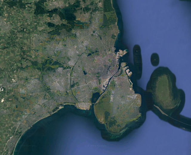
Copenhagen is located on the eastern edge of the island called Zealand in Denmark and spans to the adjacent smaller Amager Island. Zealand is the largest island in Denmark, and lies between the peninsula of Jutland, the largest body of land in Denmark, and Sweden. Between it and Sweden runs the Øresund, the most favorable channel for navigation between the North Sea and the Baltic.
In general Denmark is a very flat country, with few hills and shallow coastal waters. This has meant that it is relatively easy to build artificial land in the midst of coastal waters, creating a very malleable coastline that has been extensively shaped by human artifice over time. This is especially true in Copenhagen, large sections of which are on land “reclaimed” from the sea.

pretty flat


Early Development 1200-1600

In the 11th century Copenhagen (København), initially known simply as Havn (“harbor”), appeared as a fishing village. Its favorable location on the Øresund led to its growth as a town and an increasingly important port. It was given by the King of Denmark to the bishops of Roskilde to rule in 1169. The bishops constructed a castle in the 12th century on a small island in the harbor which came to be known as Slotsholmen (“castle island”). Stone walls were built enclosing the town in the 13th century. As the town rose in importance in international trade, it entered into conflict with the Hansa league, which functioned as a German shipping cartel and sought to control trade routes in the Baltic. The city’s defenses were overrun and the castle destroyed in 1369 by the Hanse, and further wars with the league took place in the early 15th century.
               The city walls concentrated urban life in a limited area. Three gates: west, north, and east, were the only entry points to the city and were locked in the evening. The footprint of these walls, routes leading to and from the gates, and the internal street grid of the medieval town are still evident in the built form of the city. A new castle was built on the ruins of Slotsholmen in the late 14th century, which was occupied by the king in 1416 when the city was reclaimed from the bishops by the royal crown. The site of the castle became the seat of power of the Danish state and continues to be until the present day. By the year 1500 the city’s population was only about 5,000.


Renaissance City 1600 – 1807

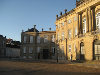
Amalienborg Palace and guard
Throughout the 16th century the city grew in prominence as a port and national capitol. In 1648, after centuries of being elected by leading nobles, the Danish crown became a hereditary absolute monarchy. The consolidation of state power in the city lead had important effects on its development, particularly in the increasingly elevated profile of the monumental architecture of the state and in the social and economic effect of the professional class of bureaucrats, soldiers, and sailors that came to reside in the city. In the late 16th century the city fortifications were expanded and shallow harbor areas were filled in, approximately doubling the city’s size. Later, areas of the harbor would be filled in further increasing the land area of the fortified city. These new areas of the city, the largest of which was to the north of the old town, were platted with a rational grid of streets in contrast to the winding pattern characteristic of the medieval center.

City walls, streets, and developed areas as of 1535 in orange, as of 1750 in pink. 


Nyboder
This renaissance quarters of the town reflects the expansion in state power that took place during this period. The Nyboder (“new houses) complex of rowhouses were constructed beginning in 1631 to house the personnel of the increasingly important Royal Danish Navy. Nyhavn (“new harbor) was developed in the 1670’s as a harbor, mercantile exchange, and maritime gateway to the city via Kongens Nytorv (“King’s new square”), a major civic plaza. North of Nyhavn, the Frederisktaaden area was developed in the early 18th century, featuring the city’s hospital, bourgeoisie mansions and the sumptuous Amalienborg palace complex for the royal family.
Nyhavn
Meanwhile, the island of Slotholmen was expanded considerably and developed with new state buildings, notably the Børsen stock exchange which was constructed in 1640 along with harbor and military facilities. The old castle was rebuilt as Christiansborg Palace in the 1745.


Børsen, with its awesome dragon spire
The 18th century proved to be rich in catastrophes for the city of Copenhagen. The cumulative effect of this was to wipe most of the city clean of its medieval building stock and to launch a major period of reconstruction over a relatively short period of time. The city was hit by plague in 1711 which reduced the population by a third [need source]. This was followed by the Great Fire of 1728 which consumed most of the old town as well as the old castle on Slotsholmen. A second Great Fire occurred in 1794, which again burned most of the old core as well as some of the more recently developed areas to the south and east. Many important civic buildings which were rebuilt after the first fire were again destroyed in 1794, including Christiansborg Palace and the City Hall.

Finally, in 1807 heavy artillery bombardment by the British Royal Navy and an ensuing fire destroyed several important monuments most of the areas of the old town that had been spared from the fire of 1794. The population of the city rose to about 60,000 by 1750 and 100,000 in 1800.


Sunday, September 11, 2016

Generalized ethesia

How does one experience culture?
At the broadest level, you sort of float in it. It's all around you and you can vaguely perceive it's nature based on how you float... Maybe it's viscous, maybe it's acidic, maybe it's transparent, maybe it's warm, maybe it's dense and you float right to the top.

You live in another country and you get this sensation that culture is going around all around you, and you're aware of it because it's different from what you're used to. You can't know very much about any particular aspect of it, because it's in a language you don't understand and draws on knowledge and traditions and inside jokes that you just don't get. But you have a diffuse feeling of awareness, the way you do about everything else that is new and different, the way you do about putting on a new shoes or pajamas that are fresh out of the dryer. It's probably this generalized esthesia I experience when traveling that makes me feel I'm closer to God than at any other time.

~

I'm an American in Europe, which is a thing I've never been before. I study the buildings, I read history, but I also hear the music and watch movies and TV. Of course, I watch more American and British movies because they're in English. I am biased in that way. You get this idea about America, though, of the role it plays in the culture here. There's the huge political and economic forces it represents, but those things run under the surface hard to distinguish most of the time. More often, the cultural products of America arrive here, in the form of music, movies, fashions, craft beer (Yakima {here pronounced Yak-KEE-mah} Valley hops FTW) and ideas and they have this quality of freshness, of rawness, of cultural mixing, of a compelling and somewhat subversive sincerity of emotion. It is more attractive for its peculiar foreignness, which provides a romantic setting for a hazy fantasy.

Back home, we drown in newness, it feels like we have no roots, like we are so mixed that we're just a mess, and those massive economic and political forces are much more visceral. We romanticize older cultures for their stability, their unique customs, their roots, their integrity. Songs, books and film from Europe especially provide a conveniently strange, yet intelligible stage for romance of a world with less disruption, slower paces, life at a more human scale.

I love that people are like this, that they look to other cultures with curiosity and awe. (Side Bar: When is it awe and curiosity but not contempt or fear?)
Being from Seattle, I am exotic here in a way that I did not expect. It's not a particularly important city globally. Most folks don't know that Microsoft and Amazon are based there, or I suppose, they don't care. They know about Starbucks, though. But it represents some mountainous, mossy green fringe on the faraway edge of the easily understood. And coffee and beer too.

I got started thinking about this after seeing Captain Fantastic at a theater here. It's a movie that represents two very different sides of peculiarly American culture. The house was packed.


Thursday, September 8, 2016

Valle, Indre By, Gehl, "Livability", What I'm doing

So, what is it that I am actually doing here?

I am studying in Copenhagen on a Valle scholarship, a program created to foster engagement between scholars at the UW and in Scandinavia. It is open to graduate students from UW and from any of the partner schools in Scandinavia or the Baltic States in built environments, civil engineering, and environmental engineering. As an urban planning student I fall within the UW's College of Built Environments, and was able to apply to study in Iceland, Norway, Sweden, Finland, Estonia, Latvia, Lithuania or Denmark. I ultimately applied to conduct an independent study on housing in Copenhagen, Denmark on the advice of a few enthusiastic boosters of that city, and was able to arrange a guest researcher position at Aalborg University's branch here through some luck and generous referals (Thanks Bry!).

My project is to study housing in the context of a "livable", compact city.

Copenhagen is compact. Copenhagen is about two and a half times as densely populated in Seattle. That means the entire population of their city (plus the jobs and parks and infrastructure and everything else) fits into about a third of the area of Seattle. Copenhagen's population is about 6/7 of Seattle's (591,000 / 684,000), so it's pretty close.

That means there is much more room for farms and natural areas surrounding the city. It means more efficient heating and other utilities and less costly public infrastructure. It also means it's much easier to get from one side of the city to another. Transit is good in Copenhagen, but the city's bike lane network is incredible. Cycling is the most popular way to get around the city, accounting for about 45% of all trips. Again, this is possible because the city is, physically, not that large. Together all this makes Copenhagen one of the most sustainable cities in the developed world.

Copenhagen is also renowned for it's "livability". Livability is a peculiar term that refers to how easy and how enjoyable it is to live in a place. It refers to the number and quality of parks, useful and exciting businesses, engaging cultural events and quality of social services that are present and easily accessible in a place. Copenhagen has been ranked #1 globally in livability in 2014, 2013 and 2008. That was by a magazine called "Monocle" which I had never heard of, and I'm not going to pretend this is a rigorous measurement. Still, it means something about how the city is perceived by locals and the global community.

The goal of my project is to profile the housing that supports this relatively high density while maintaining (and/or promoting) such a high standard of urban life. What is it like? How is it laid out? When was it built? Who built it? Why did they design it the way they did? Who owns it? What are the regulations that govern it? How much does it cost?

I want to know these things because I think it is important for Seattle to learn how to be a denser city in the 21st century without degrading our quality of life. Conversations about density in Seattle tend to devolve into nightmare scenarios of New York ghettos or soviet gulags, which is a little bit hilarious, but also unfortunate. Because of our cultural, technological, and historical context out west we are used to a very spread out way of living. This can be nice, but it has real consequences there are other ways of living more compactly that are not like a soviet gulag. This is what I want to learn.

I'm applying these questions to different areas around town. The first neighborhood I've been looking at it the oldest part of the city, called Indre By ("Inner City" in English {linguistically I think by is related to the word "build" in English which in Danish is bygge. Also the by in "bylaws" comes from the same root.}).

Indre By was the whole city up until about 1850, but was first built up in the late middle ages. It has an excellent natural harbor and strategic location on shipping routes meant that the town grew fairly quickly, and by 1500 it was a walled city with a population of about 5,000.

The walls were expanded during the early 1600's and ultimately demolished in the mid 1800's, but the heart of the city has maintained the small, tight grid of curving serpentine streets and compact public squares of its early days.

The blocks here are small, and they have very high building coverage. Though the street and block pattern of this part of the city dates back to medieval times, the building stock mostly does not. The city burned down twice during the 1700's, and was heavily bombarded by the British during the Napoleonic wars. An old church survives from 1474 and there are a number of houses from the 1600's, including the famous Nyhavn row:
 but the most of the buildings in this part of town date from around 1795-1850.


These buildings are blocks of flats that front on the street and have small interior courtyards. Historically the small courtyards in this part of town were used for keep livestock, privies and light industry; today they are mostly used for bicycle parking, storage, utilities and dumpsters. The courtyards provide access to more apartment buildings inside the block called backbuildings. Almost all buildings are between three and five stories. They tend to be quite compact. On the block I measured, their widths vary between 7.5 and 18 meters wide (about 25 to 60 feet), with an average width of about 12 meters (40 feet). The apartments are reached by stairwells, which typically access two apartments per floor. Larger buildings have multiple stairwells to reach more apartments. Some buildings have been retrofitted with small elevators, but I believe this is uncommon.

The density of windows and entrances, the narrowness of the buildings and their variation in facade color and treatment, the narrowness of the streets, their cobblestone pavement, their liveliness, and the many small businesses all tend to reward the pedestrian with a very stimulating and enjoyable environment. It is visually pleasing as well as mentally stimulating because there are many things going on, and you have to look at each one to try and figure out what it is.
Strædet, one of the first streets that went car-free in Copenhagen
Many of the streets and squares in this area have been gradually converted to pedestrian-only streets (plus relaxed cyclists). This transformation was spearheaded by the architect and urban planner Jan Gehl, who is the most famous Dane among people like me. Strangely, most Danes have not heard of him. Gehl made his career working on the seemingly obvious idea that people and their experiences matter.

Yesterday I got to join with a group from my university who is in town for two weeks on the "Gehl Studio" trip, in which they will study the city and then try to bring their insights home to apply to a project in the Seattle area. We visited the Gehl Architects office and heard a presentation about their work and methods to document human activity in public places (walking, sitting, playing, talking, watching) and to design places that promote and protect such behavior. Much of it was familiar to me from years as a planning/urban design/active streets nerd, but something about the nature of the common-place, low-intensity behavior that they seek to document means it easily slips out of the front of one's mind.
Before/After: one of the streets in Copenhagen banned to cars
The work they do to develop clear methods and measurement criteria and to communicate effectively is all the more important for how seemingly mundane the subject is. As they said in the presentation: You must measure what you value. Things like automobile counts, speeds and gas prices are easy to measure and we're used to hearing about them. Measurements yield data and data influences policy, especially because it gives politicians cover when pressed on the results of their spending programs.

What is revolutionary about this method, is a reevaluation of which are the things are truly valued, and make sure that these are the qualities we are measuring and seeking to promote through policy and design. The effect of this philosophy, along with much hard work by Danes whose names I don't know, has yielded a city with exceedingly pleasant qualities to pass through at a slow speed, immerse oneself in its fascinating places, spend time socializing with friends or family, visit as a tourist, or simply to be a person around other people.

It's people-habitat. It's compact and livable. Gehl and others have effectively documented the magic that happens in the streets. But what about that which surrounds the streets, equally as mundane, the places where the walkers and cyclists and shop owners and AirBnB toursits begin and end each day? The boring vernacular architecture of the guts of the city, usually not designed by any architect, but built to fill the needs of the day by craftsman who learned their skills on the job from their more experienced peers. It's form, cost, location, relationship to the neighborhood and type of ownership all bear on how it fulfills its function. Clearly, something about it works well here.

That's what I'm here to learn about.


[Update: Google Photos made this silly video of things I captured during my tour around town with the Gehl Studio group. It's actually kind of cool.]

Thursday, September 1, 2016

I dag


September! Happy Labor Day (has that happened yet?)!

I am still here, still alive, working, consolidating, expanding my zone of comfort in this strange wonderful city, of 2.3ish million people (metropolitan area), the capital of the Danes (total population 5.7 million), on the Øresund - the narrow connection between the Baltic Sea and the North Sea/Atlantic Ocean via Skagerak (the coolest word) and Kattegat, a flat green country, a member or the European Union and the Schengen zone passport control area, built of bricks and stone, populated by unnervingly attractive people, where the sun has just set on the first day in September.


I am in my room, in a small apartment which I am sharing with Renato, a 46-year old Sicilian man and his incredibly sweet dog named Cesar. It is on the fourth floor (in the USA we would say the fifth floor) of a mid-century walk-up apartment building, part of a group of buildings of many vintages that enclose a large courtyard with a playground in the center, a housing type that dominates most of Copenhagen and is one of the subjects of my curiosity and study here.

The apartment block where I live

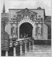
The apartment is in Nørrebro (pronounced "noy-bro" I believe) and it is probably the most diverse neighborhood in Copenhagen. There is a large muslim population, meaning there are many middle-eastern markets, shwarma shops, and there is a large mosque which was recently constructed several blocks away. It is also a youngish, lower-income neighborhood. It might be in danger of gentrifying. It is one of the historic inner-ring quarters of Copenhagen, and is named for its historic relationship to the "northern" gate in the city fortifications - Nørreport.
Old city gates


This neighborhood, along with Østerbro, Vesterbro, Frederiskburg and Christianshavn was quickly built up by the rapidly growing population of the industrializing city of the mid to late 1800's, and linked to the downtown via street cars.

I am very happy to be in an apartment after two weeks spent in hostels, searching for an apartment and living out of my suitcase and backpack.  I have never stayed in hostels in a place where there are so many of them and so many travelers. While there are many young people travelling Europe for pleasure, the hostels also served a number of people like myself who were looking for longer-term housing. I am fairly lucky that I got a place as soon as I did, given how few openings there were and how many frantic students were fighting over each one.

The hostel time was fun to meet people from all over (mostly: Germany, Italy, the UK, and Spain. Also some folks from the USA, Canada, and Argentina). People mostly younger than myself, some in college, some about to begin college, some having graduated and gotten jobs and now travelling on their own. Apparently I do not look my age. Everyone is surprised that I am 29. Perhaps it is how I carry myself, that even after all my twenties I don't live much differently than I did when I was 22. I certainly have changed, but I don't have many more possessions and I have no more wealth, (though I have significantly more debt) than I did then. 
Happy, attractive young people from the UK, Netherlands, and Germany
Quick common-room conversations require you to explain who you are and how you got to this particular place, and I can't help but wonder. I am by all measures immensely lucky to be here, to have funding, to know what I love to learn about, to have the institutional backing and cultural affirmation that it is a worthwhile thing to do to learn about, to be free from a thousand things that could weigh me down and impede my freedom at this point in my life. Traveling can be a deliciously lightening experience, but living in a new place always involves a culture shock, some alienation and anxiety. That I am doing my work independently here, supported in a general way but not port of any particular group or program potentially heightens this anxiety. 

Still, whatever it is that I am, twenty-nine years old, I am a traveler. I have lived on three continents before this one. It was just over ten years ago that I returned  from South Korea (at the behest of their government). It is nine years since I learned to dance and drink rum and also played chess with Andrew Shaw Kitch in the Dominican Republic. It is three years since I came back from the Peace Corps in Paraguay. I do believe in my work, and I find it compelling, and the greatest challenge for me going forward in my time here will be to organize myself and the work I wish to do. I must visualize the work I want to do to make the project I am creating awesome, and plan the time and needed prerequisites in order to do that work.

I will attempt to lay out how I see that project in future posts. I will also try to use this blog to communicate my findings and to regularly publish bits of my work. I am excited to learn and write about the history of this city as well as its European context which is new to me. I am excited to share drawings and images I will be creating to attempt to convey what I am learning. If anyone reads this, I am grateful for your attention and for feedback and questions you may have. I have a limited amount of curiosity and ingenuity that I can deploy at any one stretch and it is wonderful to receive a bit of either from someone else.

This place is fun to draw.